Our State
and
Our
Country
| |
Our StateandOur
Country
|
|
|
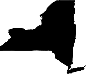
Our class is learning about the fifty states. These states make up our nation, the United States of America. New York is one of these states. It was a colony of Great Britain for over a century. In 1776, New York declared its independence and became one of the 13 original states of the Federal Union. Look at this map of New York State. > > > > Look at its border. Trace the border around the picture of New York State. What are the names of the states and countries that share the border with New York?The states that border New York are Pennsylvania, New Jersey, Connecticut, Massachusetts, and Vermont. There is also a country that shares the border with New York. That country is Canada. |
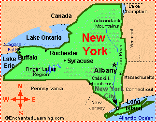 |
| Pennsylvania and New Jersey are below New York on the map. Canada is above New York on the map. Vermont is beside New York State. New Hampshire is beside Vermon. Vermont is between New York and New Hampshire | |
 |
Our
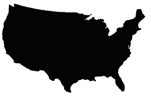
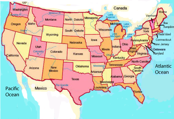
country has fifty states. Canada and Mexico are two countries
that share
borders with the United States. Trace the border below the United States that we share with our neighbor Mexico. Trace the border above the United States that we share with our neighbor Canada. Trace the border to the right of the United States and find the Atlantic Ocean. Trace the border to the left of United States and find the pacific Ocean. |
| Some Facts About New York State New York City is the largest city in New York State. The nickname for New York City is “The Big Apple.” The nickname for New York State is “The Empire State.” There is even a state song! It is called "I Love New York!"  |
|
| Table of Contents | Lesson Objectives |
Prepositions | Where is that State? |
Can You Find It! |
Test Yourself |
Resources |